Photographing Ilhéu das Cabras: A Drone Perspective from Terceira Island, Azores
When planning an Azores photography trip, Terceira Island often surprises people with the unique landscape, mainly the Patchwork, and its dramatic coastline. One of the most iconic spots on the island is the Ilhéu das Cabras (Goat Islets). On a recent session, I captured a completely new perspective of these volcanic formations. I’ve photographed this spot several times before, but never quite like this, and it completely changed how I view them.
I usually like to photograph close to my subjects, even with a drone. Proximity adds a powerful sense of depth, creating an almost 3D effect in the landscape. One of the biggest mistakes I see beginners make in drone photography is immediately flying as high or as far away as possible just to catch the "full view," losing all that crucial detail. But occasionally, I break my own rules, and this was one of those times.
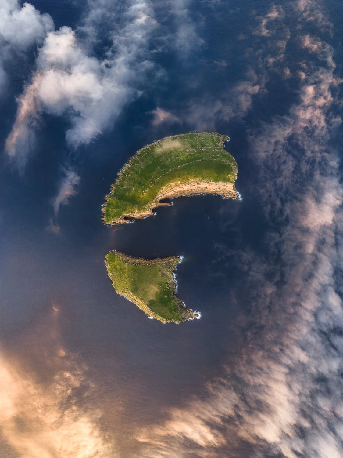
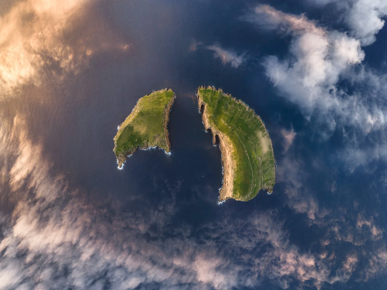
The Ilhéu das Cabras sits just off the coast of Terceira Island. While they appear to be two separate islets today, they are actually the remnants of a single, ancient submarine volcanic cone, split apart by tectonic faults and carved by centuries of relentless Atlantic erosion. From above, this geological story becomes immediately clear. I went higher than I normally would (don't ask), and used DJI's Wide Angle panoramic mode to build the composition.
The Wide Angle pano outputs a JPEG, and honestly, the composition it produced was really good. The way the mode corrects for the lens created this unusual perspective that I immediately liked. The islands looked like they were floating over the Atlantic Ocean. I wanted to keep that.
The Editing Process: Replicating the JPEG Magic with RAW
The problem is that a JPEG only gets you so far in editing. So I took the 9 DNG files and stitched them manually. The goal wasn't to reinvent the image, it was to get as close as possible to what I already liked in the JPEG, but with full control over the colours and tones.
That's something I've noticed more than once with drone photography in the Azores: the in-camera JPEG from a panoramic can produce really interesting compositions, things you wouldn't necessarily plan for. It's worth looking at them carefully before moving on.
Replicating that JPEG composition with the raw files isn't straightforward. It took several passes: Lightroom first, into Lens Corrections, Manual tab, pushing the Distortion Amount slider well beyond what I'd normally use. Then Photoshop, using Free Transform, adjusting until the geometry matched what I had in my head from that JPEG.
It took longer than expected, and there's a point where you're just making small moves and hoping it clicks. Eventually, it did.
Vertical vs. Horizontal Crop
The final image exists in two versions. I used the vertical crop on Instagram because the format just works better there—it fills the frame and hits harder on a phone screen. But if I'm honest, I prefer the horizontal orientation for my portfolio.
The low clouds sitting around the islands made the shot. Without them, it's just an aerial view. With them, it becomes something else entirely.
Gear & Software Used: DJI Mavic 4 Pro | Adobe Lightroom & Photoshop
Plan Your Azores Photography Adventure
Want to photograph breathtaking spots like the Ilhéu das Cabras yourself?
If you want a fully guided experience, check out my tailored Azores Photography Tours.
If you prefer exploring the islands at your own pace, grab my detailed location guide over at Azores Best Photo Spots to unlock coordinates, best times to shoot, and insider tips.